Catchments
Our rivers run from ‘Peak to Port’ through a catchment that has the best of both rural and urban areas. We cover South Yorkshire and North East Derbyshire.
The Don Catchment is made up of five operational catchments: the upper Don, middle Don, lower Don, Rother & Dearne. Click on the map sub-catchments to find out more about the status of our rivers, and the issues they are facing.
Interactive Map
Welcome to our interactive catchment map. Click on each of our 5 catchment areas to discover more information about each region.
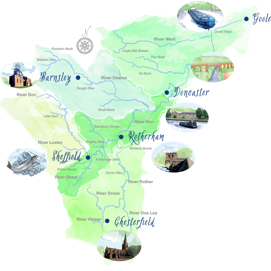
Lower Don
Starting in Doncaster, the lower reaches of the Don become tidal before reaching the bottom of the catchment and flowing into the River Ouse at Goole.
Click the button below to visit the Environment Agency data explorer for the lower Don operational catchment.
Dearne
Rising on the edge of the Pennines, the Dearne flows through Barnsley to meet the Don at Denaby Main.
Click the button below to visit the Environment Agency data explorer for the Dearne operational catchment.
Middle Don
The middle Don flows through the centre of Sheffield and Rotherham to Doncaster.
Click the button below to visit the Environment Agency data explorer for the middle Don operational catchment.
Upper Don
Rising in the Peaks, the upper reaches of the Don are joined by the Loxley as it enters Sheffield.
Click the button below to visit the Environment Agency data explorer for the upper Don operational catchment.
Rother
The river Rother rises near Clay Cross in North East Derbyshire and flows through Chesterfield to meet the Don in the centre of Rotherham.
Click the button below to visit the Environment Agency data explorer for the Rother operational catchment.
Follow the link below to read the commited plan for the care and improvement of the River Don Catchment.